Site plan in, client report out.
Four steps.
Upload your PDF before you leave the office. Do everything else on site — pin trees, record data, snap photos — then export before you're back at the truck.
Upload Your Site Plan
Load any PDF — engineering drawings, landscape plans, survey documents, even hand-scanned field sketches. LogLog doesn't care about format or orientation. Pinch to zoom, pan around, and you're ready to calibrate.
Before you start pinning, set the plan's scale so pixel distances convert to real-world measurements everywhere in the app. Tap two points you can measure in real life — opposite corners of a building, a known property line — and enter the distance between them, or type a known ratio straight off a printed scale bar, like 1:100. Takes a few seconds, and you can redo it later if you get it wrong.
Already at the site and forgot to upload? Open LogLog on your phone, grab the PDF from your files, calibrate, and start pinning trees right away. No desktop needed, no pre-registration of site plans.
Drop Tree Markers
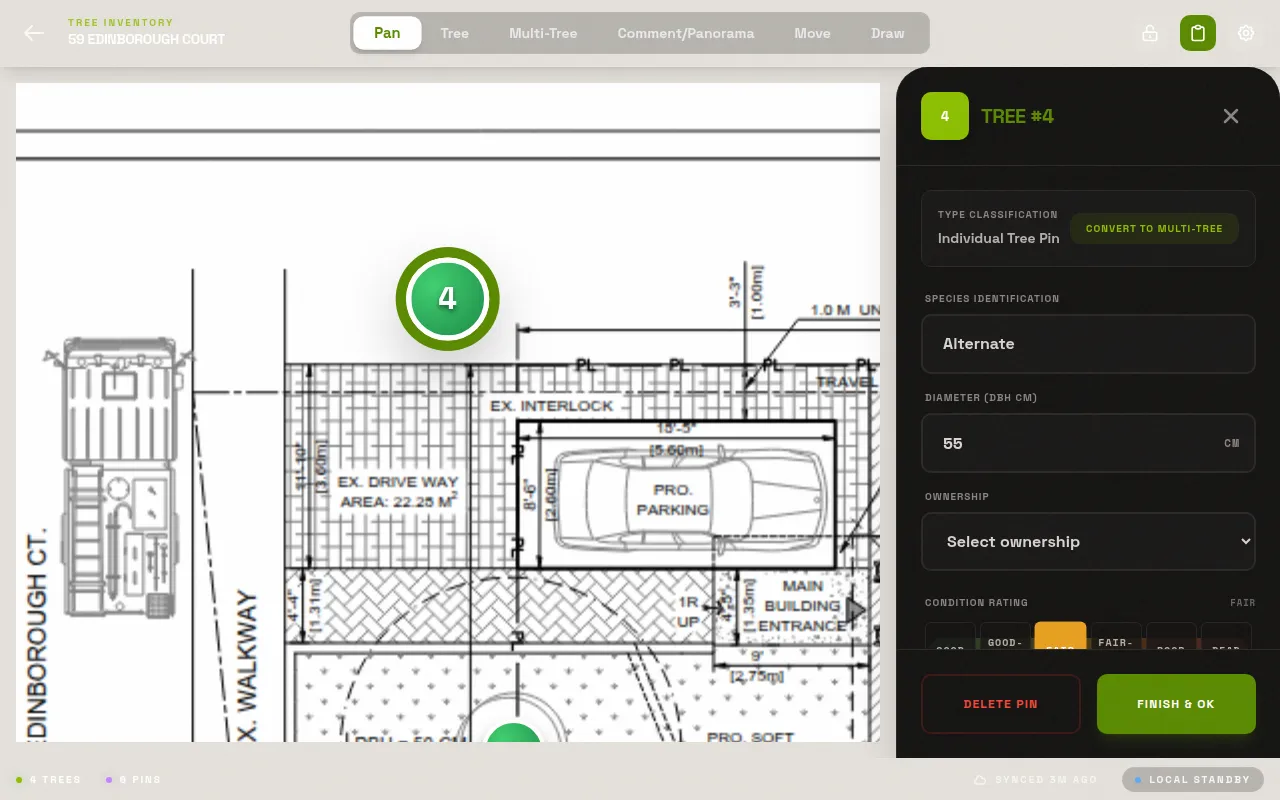
Tap anywhere on the plan to place a numbered pin. Pins auto-increment — tree 1, tree 2, tree 3 — so there's no numbering to manage. Move a pin by dragging it. Delete one with a long press. Each pin is a full tree record waiting to be filled in.
The numbered markers in the exported PDF match the row numbers in the exported spreadsheet exactly. No cross-referencing, no "which tree was number 47 again?"
Record Field Data
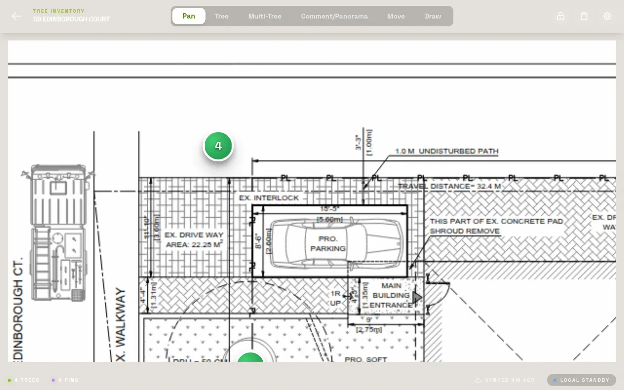
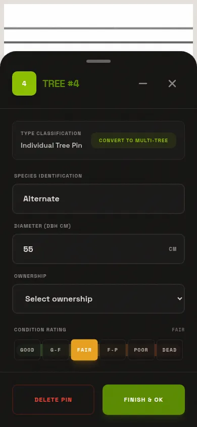
Tap a pin to open its record. Enter species, DBH, condition rating, and any free-text notes. Attach photos directly from your camera — they link to this tree and nowhere else. Once you're in a rhythm, one tree flows into the next without much thought.
Works offline. No cell signal at the back of the property? No problem. Everything stores locally on your device and all your data is preserved exactly as entered — no connectivity required until you're ready to export.
Export Everything
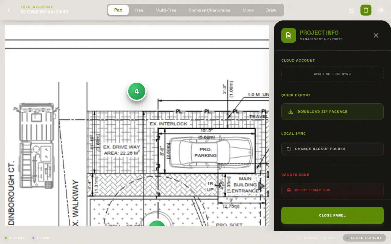
One tap exports a ZIP containing: the annotated PDF with all numbered pins burned in, an Excel spreadsheet with every tree record, and a folder of photos named by tree number. The ZIP is ready to email to a client or drop into your document management system immediately.
No additional software, no formatting work, no assembly required — the export runs right there on your device. What the client receives is exactly what you recorded in the field.
Setup
On site
Export
Why there's no live GPS map
Every pin above sits on the site plan you loaded, not on a live GPS map — that's a deliberate choice, not a missing feature. The plan is what your client, the planning authority, or your own report template already reference, so pinning trees directly onto it keeps your record tied to the document everyone else is using. If your job needs georeferenced, coordinate-system-aware GPS capture — surveying a right-of-way with no existing plan, for instance — LogLog isn't built for that workflow today.
See it for yourself.
Free to start. No app store needed. Works on any phone or tablet in any modern browser.
Get early access Open the app